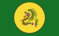
Administrative divisions of Teotiyolcan
 | |
|---|---|
| Administrative divisions of Teotiyolcan | |
| First-level | 15 altepetem 1 royal district 2 territories 58 Co-Sovereign Tribal Lands |
| Second-level | zancualteptem and tlatlacoyaltepetem |
| Third-level | calpolli |
| Fourth-level | chinamitl |
![]() Teotiyolcan is a state with a diverse variety of landscape and people. After a period of centralization in the late 1500s, what was formerly a state composed of various small city-states paying tribute to and accepting oversight from the Emperor in Callinatlacan became a country with a higher degree of central control, and more power invested in the largest city-states in each region. In recognition of the fact that the main administrative divisions, altepetem, are organized around the largest settlement within them, that is what often (but not always) gives them their name. There are also territories, the royal district, and tribal lands of some native groups that were not simply assimilated into Teotiyolcan proper. At the second level smaller altepetem make up county-size groups, and at the third level calpolli represent municipalities. Chinamitl are a variable fourth-level division that may represent neighborhoods, hamlets, or other smaller divisions within a calpolli.
Teotiyolcan is a state with a diverse variety of landscape and people. After a period of centralization in the late 1500s, what was formerly a state composed of various small city-states paying tribute to and accepting oversight from the Emperor in Callinatlacan became a country with a higher degree of central control, and more power invested in the largest city-states in each region. In recognition of the fact that the main administrative divisions, altepetem, are organized around the largest settlement within them, that is what often (but not always) gives them their name. There are also territories, the royal district, and tribal lands of some native groups that were not simply assimilated into Teotiyolcan proper. At the second level smaller altepetem make up county-size groups, and at the third level calpolli represent municipalities. Chinamitl are a variable fourth-level division that may represent neighborhoods, hamlets, or other smaller divisions within a calpolli.
History
After a period of centralization in the late 1500s, what was formerly a state composed of various small city-states paying tribute to and accepting oversight from the Emperor in Callinatlacan became a country with a higher degree of central control, and more power invested in the largest city-states in each region. In the process, the nobility that had formerly had a great deal of control over their city-states were relegated to a less essential role as the institutions and official who had served as envoys of the Hueitlatoani, collecting tribute, were elevated to become the stewards of the city-states. These city-states (altepetem), would become the basis for the reforms under Acoquizatl II in the early 1700s and Yecnemilizticatzintli VI in the 1730s, which introduced formalized provinces and a reaffirmation of the rights of the other cultural groups in Teotiyolcan, which had been granted semi-sovereign status in a series of treaties and agreements from 1560-1689. These reforms marked the official end of the tribute period. Calpolli and chinamitl were given borders and defined responsibilities in 1809 under Motititlatonatiuh "Tlamatzintli", and their borders have since been revised three times. Motititlatonatiuh "Tlamatzintli" also instituted the territories as a way to establish a complete claim on the north of the country.
First Level Divisions
Ameyalalyuhenetl
Alyuhenetl
Anocinan
Atoyatencuatl
Capital: Atoyatencuatl
Largest City: Atoyatencuatl Population: 490,000 (2020) Type: Altepetl Other Major Cities/Towns: Zolticatoyatencuatl, Arbolle, Pico de la Silla Area: XXXXkm2 |
