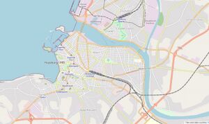
Huysburg
History
Early Colonial Period (1520-1630)
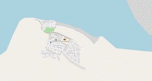
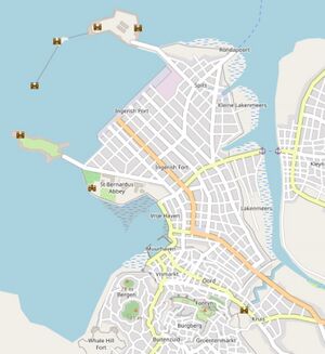
The exact timing of the founding of Huysburg is disputed, but documents from Noordkaap mention a "Huys met Burg ende Have" in 1543, most probably corresponding to Huysburg. A small fortress was build before 1550 as indicated by archaeological findings, while the a wall was build around the hilltop town center around 1575, and around the downtown harbor around 1580. Lentia trading archives from 1594 mention "Huys-by-Burgh" as a small harbor from where wood and fruits were exported. In the early 1600s Huysburg grew as an important trading center for southern Fayaan. New settlements in the Klaarmeer area produced more and more fruits that were exported to Lentia, while the logging industry became a major economic driver for the area. Huysburg became the major ship building town of northern Archanta.
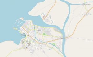
The Leeye River mouth shifted northwards after a major hurricane in 1618, resulting in fast silting up of the harbor area. Several attempts to dredge the harbor failed. A small new harbor community (Kleynhave) developed on the Leeye banks more to the north, while the old harbor became completely useless in 1628.
Late Colonial Period (1630-1720)
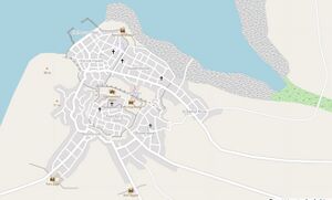
In 1629 the governor ordered the construction of a new harbour near the city center. The mudflats north of the city were drained and between 1630 and 1647 a new downtown city centre was built. City walls were extended and a new fort (Fort Domestica) was constructed. The new harbour was also walled with a seawall, partially constructed from stone, protecting the harbour from storms. But the same wall also increased siltation and harbour maintenance costs remained high.
After the Ingerish occupation in 1690, Huysburg remained an importing trading centre. New Ingerish markets opened for trade, and Ingerland further developed farming, logging and mining in the hinterland. But from the early 1700s on more and more trade went to the Fayaan City area.
During the early 1700s further silting up of the bay and harbour posed more and more challenges for the port. The Ingerish further fortified the city, connecting the city walls in the hilly southern suburbs around 1710. The construction of a large seaside citadel was started in 1712, but never finished due to increasing costs and the coastline shifting seawards (making the citadel useless).
East of the Ingerish controlled city centre, Kleynhave developed as a secondary urban centre. It flourished thanks to uncontrolled smuggling. A small fishing port/dock was built around 1695.
Ingerish Expansions 1720-1783
During the late 1710s saltation problems increased, while the population was growing fastly due to the fast development of the hinterland and the Klaarmeer area. A new Ingerish governor, William Clarke, decided on a large urban renewal project. An entire new harbor was build on reclaimed land, protected by seaside forts and a seawall. The new city was flanked by the new Sint Bernardus Abbey and hospital. A fort was built on the Whale Hill in the southern parts of town, while also landside defenses were enforced. The Kleynhave area expanded and became an important transport center, connecting the city with the north through ferries.
The fortified city proved to be well defended against pirate attacks. The city was only to a minor degree involved in the First Independence War (1755-1765), but suffered from the economic crisis caused by the war. During the early stages of the Santa Cruz War (1780-1789) Huysburg rebelled against the Ingerish, even with about 30% of the population being Ingerish. In July 1783 Ingerish troops abandoned the forts, not after setting fire in the Whale Hill fort and the harbor forts. Large parts of the downtown city were sacked and destroyed, due to Ingerish troops fighting with city militia.
Independent Huysburg Governate 1783-1801
After the Ingerish troops left, Huysburg became an independent governate. With the constant threats from pirate attacks and a suffering economy, the city went through tough times. A pirate raid destroyed parts of Kleynhave in 1794, but failed to take the city centre. In 1796 the Union of Northern Munion send a regiment to the Huysburg seaside forts to defend the harbour against raids. A major hurricane in 1799 brought more disaster to the city: some dykes breached and large parts of the Kleynhave area were flooded; the river mouth shifted southward, destroying parts of the Kleynhave settlement.
In 1801 Huysburg joined the Confederate Union of North Munion (from 1806 called Fayaan).
First Republic: slow recovery and industrialisation 1801-1870
Joining the Fayaan confederation allow Huysburg to slowly recover from the turbulent end of the 18th century. Confederate troops brought peace and security. Hinterland agriculture production and mining activities increased again. With neighbouring Hoopsbaai and Yldago Governates still independent, regional tensions remained high which didn't provide an ideal setting for undertakings. After Hoopsbaai joined the confederation the economy picked up again, but Huysburg as a port city was dwarfed by the Hoopsbaai ports.
In 1825 works started on a citadel north of the River Leeye to protect against the Hoopsbaai. Works continued until 1845. The citadel was to become a major landmark in the city for the next decades.
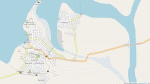
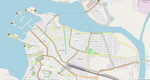
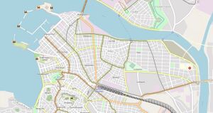
The Huysburg port was further developed during the 1840s and 1850s, with several docks being build in the basin. Smaller factories were already spread over the city during the early 1800s; but industrialization only really started in 1842 with the opening of a first textile factory. More followed soon and by 1870 Huysburg was one of the major industrial cities of Fayaan, together with Fayaan City and Witzandmond. Industrialization also meant migration of labor forces from the countryside to the city, and from the 1840s on Huysburg gradually increased from a small town to a big city. The new neighbourhouds were mainly constructed north of the city, in the coastal lowlands. North of the Lindedries an upscale neighborhood, called Park, was constructed during the 1840s. Away from the odors and noise of the harbor, it was a garden-city for the wealthy merchants.
Second industrialization 1870-1910
During the late 1800s Huysburg further industrialized, and the population was growing fast. The city combined elements of a modern industrial city with still many medieval elements like city walls and the castle.
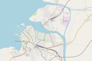
A first railway connection with Roerberg in the Hoopsbaai area (and connecting to the other Hoopsbaai cities) was constructed in 1851, with the opening of the Huysburg Noord station. This meant also the construction of a first bridge over (a branch of) the Leeye River, followed in 1853 by a road bridge a little to the west. In 1864 the railway to Klaarmeer opened, followed in 1865 by the railway to Yldago. Both connected to a new Huysburg Centraal station. An eastern branch of the Roerberg railway opened in 1874, connecting Roerberg to the Huysburg Centraal station via a large bridge over the Leeye. In 1875 the Central station building was replaced by a large building, which was (and is) famous for its splendid architecture. Also, the road network improved largely in this period, with large and fast roads (Steenwegen) to Klaarmeer, Yldago, Ronda and even two roads towards the Hoopsbaai. In addition to the northern bridge over the Leeye (1853) a large wooden bridge was built at De Veirponte in 1859, only to be replaced by a stone bridge in 1864. This made the city centre reachable from the north without a ferry. Strong tides hampered the construction of a bridge between the centre and the citadel, and the ferries remained an important part of city mobility. The first horse-drawn tram line opened in 1876, connecting the brand new central station with the docks. Over the next years, several new lines opened, connecting the most important city neighbourhoods and ferry terminals. In 1889 a tram line opened in the citadel neighbourhood. A steam tram served the harbour-Stella line between 1887 and 1894 but was abandoned because of the bad air quality and noise. In 1899 a battery tram replaced the horse-drawn trams on the line between the harbour, central station and De Veirponte. In 1908 this line was electrified with overhead wires, and by 1914 all lines were electrified.
With the second industrialization wave, large industrial factories opened in the city. Larger and more polluting industries were mainly located on Citadel Island, while smaller factories were mainly located downtown in the city centre. The most important sector has historically been textile production, mainly for export to Uletha and Bai. A small iron forge was located on Citadel Island (probably since the 1840s) and fastly grew to a large iron forge during the 1870s and 1880s. It produced a large set of iron goods for the internal market, ranging from sewing machines to ploughs to rails. From 1882 on it started to produce the Huysburg Finest Sewing Machines, later renamed Finest Sewers, which were exported globally until the 1970s. The first chemical factory opened in 1887 on Citadel Island and became part of the UCF group in 1894. Also some food-producing factories, making canned meat and fruits, and industrial brewers opened in the second half of the 19th century.
This industrial period also started to change the city landscape. In 1874 the old harbour (Muurhaven) closed, and the area was reclaimed from the sea in 1879. The harbor basin remained a polluted pool until 1907 when the Muurhaven Park was created. Poor workers neighbourhoods were constructed all over the city (called Beluiken). The upscale Park neighbourhoud extended west.
Towards a modern harbour city 1910-1960
Economic downfall and the Munion War had a large impact on Fayaan but Huysburg fared relatively well through this period. Some major investments in city infrastructure in the first half of the 20th century shaped the city into a modern harbour town.
Building of the riverside harbour was the result of the silting up of the Leeye River and because the existing harbour could not foresee the needs of modern shipping. From 1914 to 1922 the right bank (Citadel Island) was reshaped: the tidal flats in front of the citadel were reclaimed and the Citadel Dock and Handels Dock were constructed. Between 1919 and 1926 also the left bank saw major construction works with a new industrial site and harbour between Dampoort and Rondapoort. Those works narrowed the river mouth, which in the end also slowed down siltation. The metal suspension bridge Goeverneursbrug was opened in 1934, connecting the downtown area with the Citadel Island. With a 32 m clearance below the bridge at high tide, it doesn't hamper modern ships. In 1952 large scaled works began on a new harbour and industrial area on Citadel Island, catering for the demands of large modern ships.
Also road infrastructure changed a lot: increased horse-drawn goods traffic in the early 1900s required larger roads. From the 1920s on slowly cars were introduced in Fayaan, requiring better road standards. The introduction of diesel trucks in the 1930s also required better road infrastructure, especially for the industry and harbor zones. Different city districts were reshaped and large roads were constructed, a trend that would be even amplified after 1955. few changes happened to the rail infrastructure, that still provided the best connection between Huysburg and surrounding cities. Trams were modernized gradually, and still served as an important transport means within the city. In the beginning of the military rule (1938-1949) some regional light rail/tram lines were build to suburbian villages. From the 1950s on busses began to replace the tram systems in Fayaan.
These societal changes are reflected in the new cityscape of Huysburg. The Citadel Island further industrialized and urbanized. The Governerusbrug bridge ensured better connections to the downtown city, although ferries still ran frequently. A new general hospital was constructed during the 1940s. Parts of the citadel were torn down for a new industrial zoning in the 1910s-1920s, while the rest was converted to a public park in 1923. The existing tramline was complemented with two new lines in 1915 (to Metaalfabriek) and 1928 (to Zeebries, in 1947 extended to the general Hospital).
In downtown, draining and levelling the former marshes and removing the city walls in the late 1920s was combined with demolishing and reconstructing the Dampoort and Lakenmeers neighborhoods. A new primary road was constructed here, connecting to the new port industry zoning and the 1934 Goeverneursbrug. The Centraal Station Square became the center of downtown traffic. The Kleyn neighborhood impoverished greatly and fell into ruin. In contrast, the Park neighborhood remained a green upper-class residential area. In 1914 the Lindedries was transformed from communal meadow to recreation site, with the cities first soccer stadium. In 1925 the enginering college "Hogeschool Park-Huysburg" opened, and in 1928 the Park Hospitaal. The marshes northwest of Park were drained between 1954 and 1957, to build more residential areas.
In the upper town, the Yldago road (between the Vismarkt and Buitenzuid) was remodeled in 1912, and large parts of the Buitenzuid and Bergen neighborhoods were demolished and rebuild. The Whale Hill Fort was demolished in 1939 and replaced by a green modern neighborhood and park. A coastal bypass towards Nieuwendam required the building of the Whale Tunnel that has a 6.8% gradient. The tunnel and bypass were completed in 1949. The Stella neighborhood increased a lot between 1940 and 1955 as did Boerenwijk.
The 1940s and 1950s was also the start of the urbanization and growth of several suburban villages. notably east of the river (Poelmeers and St Pieters) and south of the city (St Maarten, Veewyde and Rodekerke).
The era of the car 1960-1995
Although cars became already more common in Huysburg in the 1940s and 1950s, the 1960s was truly the start of the era of the car.
Several major infrastructure works shaped a car-oriented city:
- Two new harbor districts shifted the industry to the north: the Nieuwe Haven on Citadel Island (opening in 1957) and the Whitten Haven (Depaep Dock opening in 1965; Container Dock opening in 1982).
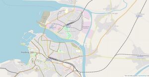
- The highway to Roerberg/Hoopsbaai (A1) opened in 1964. It connects the northern parts of Huysburg, and especially the harbor, to Fayaan City, and soon became one of the busiest highways of the country. Originally ending at St Martinus Whitten, a bridge over the northern Leeye branch was constructed in 1969, and the highway was extended to near the Goeverneursbrug. This soon resulted in major gridlocks near the Goeverneursbrug.
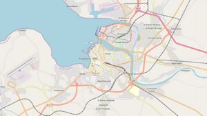
- An southern/eastern ringroad (R44) opened in 1968, bypassing the city between Rodekerke and Overponte. In 1975 it was extended to the north to connect to the Klaarmeer highway.
- The Klaarmeer highway (A1) opened in 1974, although the entire trajectory was only finished by 1987. Connecting with the eastern ringroad R44 in 1975, this highway allowed long distance traffic to bypass the city, which changed mobility in the region dramatically.
- The Ydalgo express way (A11) opened in 1984, connecting Huysburg to the south.
- An international airport was already planned in the 1940s, but works only really started in 1959 and finished in 1964.
- Tram lines closing all (except on Citadel Island) in the 1960s. In 1984 a metro project started, with the opening of the first seven stops in 1989, connecting Ingerish Port to Stella. Originally 8 lines were planned.
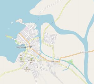
Fast population growth and urbanization resulted in growing suburban centers from the 1970s on. In 1965 the Huysburg Metropolitan Area (which includes Whittenburg) had a population of 257 000; in 1990 this had increased to 489 000. From the 1980s on the Ingerish Port neighborhood got increasingly renovated, and many old building were brought back to their former glory. Shops filled the streets, while also many office complexes opened in renovated historical buildings. Especially the insurance sector and the offices of many agriculture companies located in the downtown area. From 1987 on the historical Burgberg neighborhood, making it a touristic hotspot.
Many jobs were located on the Citadel Island, and only 5 bridges connecting that island. Also the Whitten harbor was located north of the city. At the same time many residences were located east and south of the city. This resulted in increasing traffic jams on the R44 and B14 in the 1990s. The outdated public transport system couldn't provide a viable alternative.
A post-modern tourism hotspot 1995-2022
To solve the large gridlocks in the city, a new large city plan was launched in 1995. Although the plan was never completely executed, it is responsible for many large changes that reshaped the city over the next two decades:
- the A54 connecting to Villa Ronda opened in 1998. In addition to linking to Villa Ronda, the A54 also provides a northern ringroad/bypass around the city, drastically improving the mobility in this zone
- a new metallurgy harbour was constructed west of the Whittenburg harbour. The Metaalfabriek Huysburg (now Estella Huysburg), located on the Citadel Island, moved to this new harbour in 2008. This also meant a modernisation of the metallurgy factory, with a new focus on alluminium melting.
- a new railroad plan (1998) meant the construction of a new main station (Huysburg West, opening 2010) and a southern bypass to the Klaarmeer region (opening 2012). Although Huysburg Centraal still exists, most intercity trains and all high speed trains now serve only the new West station. The bypass allows high speed trains to continue from Huysburg to Klaarmeer without turning.
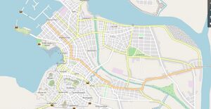
The city center was totally reshaped, with many streets turned into pedestrian streets. This happened in three phases: the initial 1995 plan focussed on the upper town (Burgberg) and reshaped the central station area. A second plan (2001) focused on downtown. A follow up plan (2016) further increased the pedestrian areas and introduced a low emmision zone, banning the most polutant vehicles from the city center. These plans meant major shafts in mobility and spatial planning of the city center:
