User:Canada LaVearn
Hello! I go by Canada. I am 20 and from the United States. I've been mapping on OpenGeoFiction since 2020, and on OpenStreetMap since 2018.
Projects
Territories
 Wisecota, FSA
Wisecota is a state in the southwestern Federal States. I have had this territory since 2022, and although I don't often keep up on actively mapping, I am usually doing something in regards to the state.
Places
- Tolanville, Michisaukee, FSA is my first (and currently only) project outside of Wisecota. The mapping process almost follows the historical growth of the city, starting at the intersection of MC-13 and MC-17, and expanding outward as I gained new ideas. Very little has been changed from its original state since its initial placement, which gives a bit of insight into how I did things as time progresses. I had initially meant for Tolanville to have a population of 1,500 or less, but very quickly (and accidentally) became a town that could reasonably hold 6,000-8,000 people.
Wiki Sandboxes
If you'd like to take a peek at what I'm working on in the background, here's links to any active subpages I have!
- User:Canada LaVearn/Sandbox, General sandbox for smaller works
- User:Canada LaVearn/Wisecota, Unlisted rewrite for Wisecota's wiki page
Miscellaneous
OpenGeofiction at r/Place
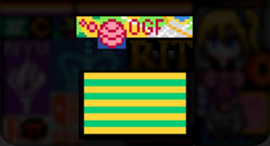
OpenGeofiction was represented on r/Place (an every-five-years event hosted on Reddit where more than a million users paint a large canvas pixel by pixel). A group of about 10 people managed to take up a little area of the canvas and create a little pixel artwork of OGF. The unique OGF globe with its initials, on a map. Later on, we created a second artwork, the flag of ![]() Navenna. The task wasn't as easy as it looks like, requiring constant activity to ensure survival.
Navenna. The task wasn't as easy as it looks like, requiring constant activity to ensure survival.
In the end, it didn't end well for our little art sets. It was a great honor to have a little community like OpenGeoFiction be represented on one of the largest projects of the Internet, just shows how great we are!
