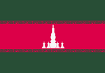
Manawa

|
Republic of Manawa ꢪꢥꢡ (Manawi) Capital: Manawa
Population: 20,547,349 (2024) Motto: ꢙꢿꢙꢭ꣄ ꢪꢿꢥꢸꢙꢸ ꢪꢱ꣄ꢫꢬꢒꢜ꣄ ꢱꢿꢙꢲ꣄ꢜꢿꢬ, ꢞꢿꢥ꣄ꢔꢥ꣄ ꢭꢸꢥ꣄ꢔ꣄ꢔꢸꢲ꣄ ꢞꢿꢡ (Jejal menuju masyarakat sejahtera, dengan lungguh Dewa.) (The trail to an opulent society, with God's grace.) |
Loading map... |
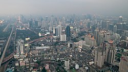
Manawa (/mɑnɑwəˌ/, pronounced: MA-NA-wah; Manawi: ꢪꢥꢡ, romanthized: Manawa, /manaˈwa/ pronounced: ma-NA-wa), officially the Republic of Manawa (Manawi: ꢬꢿꢦꢸꢨ꣄ꢭꢶꢱ꣄ ꢪꢥꢡ, romanthized: Republis Manawa, /rɛpʊˈbliˌs manaˈwa/), is a sovereign state in western Archanta. It is bordered by Majesia to the north, Wallea to the east, and AR016 to the west. To the southeast it boasts a vast coastline on the White Sea. The capital and largest city is similarly named Manawa (also known nationally colloquially by the nicknames Manawa Kota, Kota gi Akar and Kota Agung), located in the eastern portion of the country in the Great Lustrous Plain (ꢞꢜꢬꢥ꣄ ꢨꢿꢱꢬ꣄ ꢭꢶꢗꢆ (Dataran Besar Licau)).
It is a culturally diverse country home to plenty of people groups, the most numerous of which is the Lower Bawan, followed by the Arabosa, Upper Bawan, Central Bawan, Malawamba, and others. The primary spoken language is Manawi, although regional dialects between different cultural groups are prominent.
Following more than two centuries of clashing kingdoms and changing rules, the country was colonized by the Ingerish, Castellanese, and briefly the Valonians in the late XX century. For most of colonial history, both Castellan and Ingrea had their colonies in the region span lands of both modern day Wallea and Manawa. Unofficially, the colonial region was called Manawallea, although each colonial power had their own names for the possessions. The region of Manawa within the colonial possessions was known as Arabosa by the Castellanese and Manaral by the Ingerish. The country gained partial independence in 1894 from Ingrea, at the time called Cape Arabosa and later full independence in 1912 from Castellan. In 1912 it renamed itself to Alameda-Arabosa, in 1913 to Awamata-Arabosa in 1916 to Arabosa, in 1925 to Awamatanah before finally renaming itself to the present name in 1927. Following independence, it established itself as a parliamentary republic. Years of instability provoked by clashing ethnic groups brought 4 different coup d'états (in 1916, 1925, 1930 and 1961). After the 1961 coup, a socialist regime was installed which would end up ruling the country until modern day, ruled by General Guntur Firdaus. Although officially a 'single-party people's democratic republic', it has been characterized as a militaristic socialist dictatorship since the late 1960s, following the Second Mana-Wali Brotherhood War which started as a result of a decade long clash between opposing governments of Manawa and neighboring Wallea. The war escalated into a bloodbath with genocidal acts from both sides which resulted in international powers intervening to establish peace in the region and preventing the war from spilling into other neighboring countries. Since the Treaty of [tbd] in 1971, Manawa and Wallea followed different paths, with Manawa introducing a semi-isolationist political and global stance, while maintaining trade and commerce under the full control of the government.
Since 2005, the isolationist policies have been slowly reverting, with the government and economy opening up to the rest of the world. Opening up the national market has been strictly coordinated by the central government, which allowed foreign businesses to invest, and tourists to visit only certain parts of the country. The first locality open to foreign visitors was the capital city in 2006, followed by Pantaidaktir and Santo Huan of the Tepiamas province in 2009, the former of which grew into a bustling tourist destination. Since 2017, the government has opened up the entire country for investors and visitors. Manawa's economy is one of the fastest growing economies in the world, mainly supported by the extensive export of ores and minerals, however it is still classified as a LDC (least developed country), with one of the lowest GDP per capita rates in the entire world. Manawa has not been part of any international organization until 2006, when it joined the Assembly of Nations.
Geography
 | |
|---|---|
| Geography of Manawa | |
| Continent | Archanta |
| Region | ? |
| Population | 20,547,349 (2024) |
| Area | |
| • Total | 206,898.8 km2 79,884.1 sq mi |
| • Water (%) | 3.4 |
| Population density | 99.31 km2 |
| Highest point | Perisai Dewa 7,066 m (23 182 ft) |
| Calling code Internet TLD 2-letter code 3-letter code Drives on | +167 .mw MW MWA (MNW) right |
| Time zone | WUT +8 (no DST) |
Economy
 | ||||||||||||||||
|---|---|---|---|---|---|---|---|---|---|---|---|---|---|---|---|---|
| Economy of Manawa | ||||||||||||||||
| low-income participatory planned economy | ||||||||||||||||
| Currency | makota (MWM, ଲ) | |||||||||||||||
| Monetary authority | Bank of Manawa | |||||||||||||||
| GDP (PPP) | 2024 | |||||||||||||||
| • Total | 134.2 billion USD | |||||||||||||||
| • Per capita | 11,588 USD | |||||||||||||||
| GDP (nominal) | 2024 | |||||||||||||||
| • Total | 82.3 billion USD | |||||||||||||||
| • Per capita | 4,008 USD | |||||||||||||||
| HDI (2024) | 0.644 medium | |||||||||||||||
| Unemployment rate | 3.1% (2024) | |||||||||||||||
| Principal exports | raw minerals (copper, cobalt, lithium, kalmium, tin), steel, electricity, palm oil, liquefied natural gas, lumber, agricultural products | |||||||||||||||
| Principal imports | machinery, petroleum products, industrial equipment, vehicles, electronics, pharmaceuticals | |||||||||||||||
Industries and sectors | ||||||||||||||||
| ||||||||||||||||
| Exports Main export partners Imports Main import partners | Wallea 32.5% Federal States 21.1% Majesia 16.2% Deodeca 8.1% ASUN 7.7% Lutang 4.2% others 10.2% Wallea 27.3% Federal States 22.5% Huaxia 19.9% Deodeca 11.8% Majesia 6.9% CCA 6.4% others 5.2% | |||||||||||||||
| Inflation rate GDP growth rate Public debt Budget balance Credit rating | 7.8% (2024) 14.2% of GDP (2021) B- | |||||||||||||||
Demographics
| № | City (MW) | City (IN) | Province | Population (city proper) |
|---|---|---|---|---|
| 1 | ꢪꢥꢡ | Manawa | Distris Akar∈⊾ | 4,105,201 |
| 2 | ꢒꢜꢿꢭꢶꢥ | Katelina | Malawamba Bawah∈⊾ | 1,153,297 |
| 3 | ꢬꢡꢦꢸꢬ | Rawapura | Rawagelap∈⊾ | 717,945 |
| 4 | ꢱꢬꢔ꣄ꢲꢜ | Saraghata | Saraghata∈⊾ | 549,271 |
| 5 | ꢲꢬꢦꢥ꣄ | Harapan | Sampur∈⊾ | 445,785 |
| 6 | ꢨꢬꣂꢥ꣄ꢔ꣄ | Barong | Awamata Atas∈⊾ | 427,468 |
| 7 | ꢱꢪ꣄ꢦꢸꢬ꣄ | Sampur | Sampur∈⊾ | 413,248 |
| 8 | ꢱꢸꢥ꣄ꢔꢄꢱꢸꢗꢶ | Sungaisuci | Pantaibak∈⊾ | 323,583 |
| 9 | ꢱꢥ꣄ꢜꣂ ꢲꢸꢂꢥ꣄ | Santo Huan | Tepiamas∈⊾ | 251,333 |
| 10 | ꢂꢬꢨꣂꢱ | Arabosa | Arabosa∈⊾ | 214,127 |
| 11 | ꢨꣂꢒ꣄ꢜꢶꢬ꣄ | Boktir | Batuting∈⊾ | 197,227 |
| 12 | ꢜꢶꢒꢸꢥꢥ꣄ꢔ꣄ | Tikunang | Saren∈⊾ | 186,285 |
| 13 | ꢔꣂꢔꣂꢔ꣄ | Bagogog | Bagogog∈⊾ | 162,388 |
| 14 | ꢜꢿꢭꢸꢲꢬꢦꢥ꣄ | Teluharapan | Tepiamas∈⊾ | 156,004 |
| 15 | ꢱꢸꢞꢶꢬꢥ꣄ꢔ꣄ | Sudirang | Malawamba Atas∈⊾ | 152,728 |
| 16 | ꢞꢿꢒꢜꢒꢬ | Dekatakara | Saraghata∈⊾ | 149,115 |
| 17 | ꢪꢿꢪꣂꢜꣂꢥ꣄ꢔ꣄ꢔꢬꢶ | Memotonggari | Distris Akar∈⊾ | 144,520 |
| 18 | ꢗꢥꢶꢪꢿꢞꢥ꣄ | Canimedan | Padang Matahari∈⊾ | 139,446 |
| 19 | ꢂꢒꢿꢥꢱ꣄ ꢨꢬꣂ | Akenas Baro | Malawamba Bawah∈⊾ | 135,036 |
| 20 | ꢭꣂꢥ꣄ꢜꢬ꣄ꢨ | Lontar | Rumpunjauh∈⊾ | 127,627 |


