Paroy

|
Republic of Paroy République du Paroy (Valonian) |
Loading map... |
Paroy (/pərɔɪ/), officially the Republic of Paroy (Valonian: République du Paroy), is a federal republic in the southern part of Tarephia, in the northwest of the Budrian Peninsula, where it connects to the Tarephian mainland. The country is composed of 11 states and a federal district in which the capital and largest city, Coleraine, is located. Other major metropoles include Trevers, Sainte-Hélène, Bluemond and Emison. Paroy is moderately populated, with nearly 35 million inhabitants taking up the country's area of 394,181 km2. The country is relatively urbanised with most large metropoles along both the west and northeast coast. Furthermore, the country is bordered by Freedemia in the south and southeast, Dania in the northeast and Miramar in the east. The most common languages spoken are Ingerish and Valonian. Paroy is a member of the Ingerish Commonwealth, the Tarephia Cooperation Council and the Assembly of Nations.
| Republic of Paroy République du Paroy | ||||
|---|---|---|---|---|
| ||||
Loading map... | ||||
| Motto: ""Libertatem Celebramus"" Celebrate Freedom | ||||
| Capital and largest city | Coleraine | |||
| Official languages | Ingerish • Valonian | |||
| Ethnic Groups (2020) | 77.5% Uletarephian 10.2 Antarephian 7.4% Indigenous 4.5% Archantan | |||
| Demonym | Paroyan | |||
| Government | Federal semi‑presidential constitutional republic | |||
| • President | Christian Webson | |||
| • Prime Minister | Kaila Farsling | |||
| Legislature | Paroyan Federal Assembly | |||
| • Upper house | Senate | |||
| • Lower house | House of Congress | |||
| Area | ||||
| • Total | 394,181 km2 152,194 sq mi | |||
| Population | ||||
| • Census (2020) | 31,942,260 | |||
| • Density | 81/km2 209.8/sq mi | |||
| HDI (2019) | 0.917 very high | |||
| Timezone | Budrian Standard Time (WUT+2) | |||
| Currency | Paroyan Dollar (PYD) | |||
| Drives on the | right | |||
| ||||
Etymology
Although a variety of theories exist about its name, it is believed the name Paroy is derived from the Pannarangoyi word parraoia, which roughly translates to 'bulging lands'. This most likely refers to the hilly coastlines near Panaca. The name was first mentioned on a world map of Gonnar Machuni in 1578 as Para Oya, near what is now Panaca. The name was later used by Ingerish immigrants and as the colony expanded, the name would be used more often, and eventually became Paroy or Paroi. Only in the end of the 17th century the name was used as an unofficial name for the entire territory, in the time still officially named the Veronan Colonies. Another theory explains that the name comes from the Valonian pays du royaume, referring to the lands beloning to the Valonian empire.
History
Indigenous folks
Ulethan colonisation
Pretanese colonisation and the Nouvelle-Valonne
In the early 13th century, several Pretanese expeditions took place around what is now the Northwestern Paroyan Coast. A few settlements from this time remain, but due to the rough terrain in the area and the large distance from Pretany, the first Valonian colony on Paroyan ground made a slow start. But in the next century, the region was expanded rapidly and many settlements were established. Sainte-Hélène, eventually one of the largest Valonian settlements in Paroy, was established in 1327 and served as the administrative capital for the Colombe province of the Nouvelle-Valonne.
During the 15th century, the Nouvelle-Valonne started expanding on Paroyan soil. The Colombe province spread out to what is now Linton and a new province, Madison, much larger than the current state, was established in the northeast of Paroy. In 1465, Cauvigne (now Coleraine) was founded and became an important port on the Gulf of Madison for trade with Latina City and later Cordoba.
Ingerish colonisation and the Veronan Colonies
While the area of the Nouvelle-Valonne now covered almost half of the Paroyan Republic today, Ingerish expeditions explored the Paroyan west coast, and eventually started settlements in around what is today Panaca. It is believed that the first Ingerish settlement on Paroyan ground was Rosefield in March 1545. The Ingerish colony spread fast around the Veronan coast, chartering Summerton and Templeton in 1546, Melwick and Weston (today West Trevers) in 1547 and Ansley in 1551.
In 1572, the Verona Colony was established with as main purpose the transportation of goods like crystals, gold, oil, lumber and tropical fruits and spices to Ingrea and other colonies like Freedemia. Later, more and more people came to live in the newfound colony, expanding and creating more settlements and eventually more colonies. In 1595, the Trevers Colony was found by splitting of from Verona, because of the high concentration of settlements and fast growing population around the Ansy river. A few years later, these settlements were combined as the City of Trevers, creating a new economic center on the west side of Paroy.
After a short period with a lot of immigrants coming to the different colonies, the different colonies were grouped together as the Veronan Colonies in 1612. At first it served as a self-governing colony, but got the status of Dominion in 1656.
Colonial wars
Paroyan Revolt and Independence
Following the Ingerish Civil War in the 1710s, and the loosening grip of Metropolitan Ingrea on it’s colonies, many of them were forced to survive on their own. Between 1720 and 1728, many of Ingrea’s colonies like Vodeo declared their independence, mostly with success.
With the Ingerish Civil War over and the loss of many of its colonies as a result, the monarchy did everything to thwart these former colonies by discontinuing trade to them from its remaining territories. Because of new trade agreements between the Veronan Colonies and the now-independent Tarephian and Antarephian colonies and the continuation of trade of Ingerish goods to these countries, the Veronan Colonies received heavy penalties from Ingrea. This led to a steep drop in the economy of the Colonies. Lots of people lost their jobs because of the disappointing revenue from the trade, leaving many in poverty or homeless.
By February 1729, the financial crisis escalated in the Paroyan Revolt against the presence of the Ingerish government in the Colonies. A few months later, the Veronan Colonies officially declared war to Ingrea. Some harbours were destroyed, like the Port of Summerton. During the Revolt in 1731, the First Anarchistic Revolution broke out. Towns and cities were plundered, government buildings like the Governor Palace in Trevers, were destroyed and set on fire and people – mostly Ingerish officials and their families – were brutally murdered in the streets and in their homes.
In 1733, just a few days before independence, the parts of the Crystal City and docks of Trevers were set on fire by the Royal Navy. Around 8.500 people died and many buildings, including most of the western docks, were devastated. This Great Trevers Fire led to the last battle in Matthews Bay, on January 31. With the Royal Navy already massively outnumbered, they finally surrendered on February 2. Exactly a week later, the Declaration of Independence for Paroy was signed.
Confederation and Trade League
Unification and anarchy
Modern era
Geography and environment
 | |
|---|---|
| Geography of Paroy | |
| Continent | Tarephia |
| Region | Lycene |
| Population | 31,942,260 (2020) |
| Area | |
| • Total | 394,181 km2 152,194 sq mi |
| • Water (%) | 11.6% |
| Population density | 81 km2 209.8 sq mi |
| Major rivers | Ansy, Louvagne, Nissony, Loraine, Coleraine |
| Time zone | Budrian Standard Time (WUT+2) |
Paroy is in Southern Tarpehia, located on the northern end of the Lycene Peninsula, which it shares with Freedemia, Meilan, Miramar and Beldrio. It is also bordering Dania on the north-east. The country is connected to bodies of water on two sides of the country. Paroy lies mostly between latitudes 12° and 20°S, and longitudes 26° and 33°E. Paroy covers 394,181 km2 (152,194 sq mi), consisting for 11.6% of water.
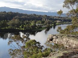
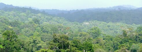
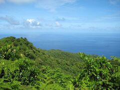
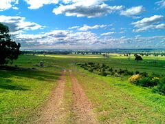
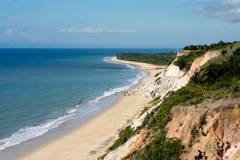
The landscape in Paroy varies wildly, with mountains and tropical rainforests in the east and south-east, mountain ranges in the north, and hills in the west and centre of the country. Paroy can therefore be subdivided in 5 geographic regions: the Coasts (West and East Coasts), the Northern Peaks (north), the Valleys (Andoras, centre), the Forests (east) and the Plains (centre/south). Dense rainforests take up 37% of the country, making it hard to settle down in most of Dorges, Radigan and Magali. Large parts of these rainforests are protected in national parks. Because of this, most of the country's population lives on the west coast and the north-east where land consists of rolling hills varying with some higher mountains and flat lands. Landuse in Paroy is very diverse. The inner land contains landscapes with wineries and farmlands, while the higher areas on the coast and the east feature more mining. At 2,160 metres Mount Lorrez is the highest mountain in Paroy.
The most important rivers in the country are the Ansy, Louvagne, Nissony, Loraine, Vale, Coleraine, Kareusse and Callabon. Paroy also features serveral lakes in various places in the country.
- Landscapes in Paroy


